
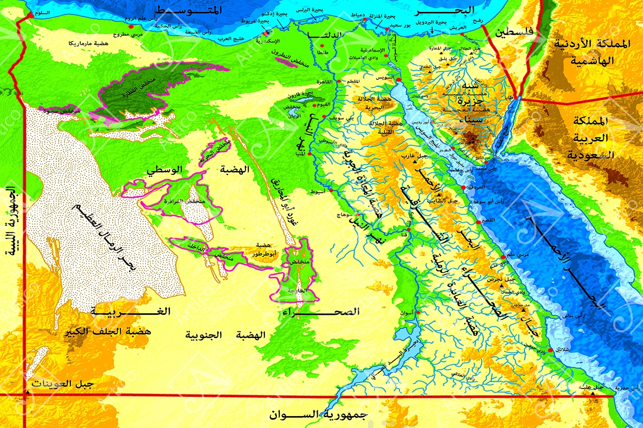
High detail map of Egypt, topographic map of Egypt in green with rivers, lakes and neighboring countries.
$1.50
File Type JPG
Pixels 6543 × 5474

Colorful relief map of Egypt with Arabic labels displays the Nile Valley, delta, surrounding deserts and neighboring regions. Blue waterways trace the river and branching channels, with the Mediterranean across the top and the Red Sea along the right.
Green, yellow, orange and brown areas distinguish different terrain zones. Red dots mark settlements, while strong red border lines and magenta outlines separate selected regions within the densely labeled map.
The Sinai Peninsula lies between the two northern arms of the Red Sea, and Lake Nasser extends southward near the lower edge. Large regional names and smaller Arabic place labels add cartographic detail throughout the composition.
Design details
- File format: JPG
- Source dimensions: 6543 × 5474 pixels
- Layout: Landscape
Download and use
The original design is supplied in a RAR package. Unpack the download to access the source file. Use an image-compatible application to view or work with the artwork. Colors can vary between screens and printing methods.
Digital product only; no physical item is shipped. Use is governed by the Articoo Standard License.
Vendor Information
- Store Name: picphoto.ai
- Vendor: picphoto.ai